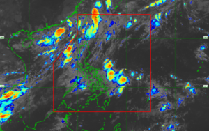
Tropical Depression Kiyapo maintained its intensity on Thursday, carrying maximum sustained winds of 45 kph near its center and gusts reaching 55 kph, according to the Philippine Atmospheric, Geophysical and Astronomical Services Administration (PAGASA).
As of 4 a.m., the tropical depression was spotted about 950 kilometers east of Central Luzon, moving west-northwest at 20 kph, PAGASA reported.
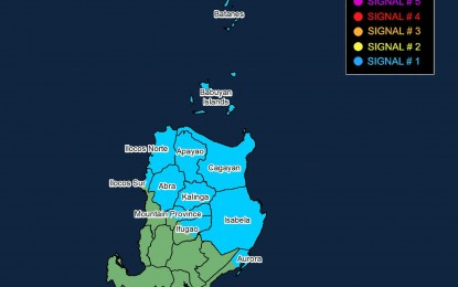
Tropical Cyclone Wind Signal (TCWS) No. 1 remains in effect over Batanes, Cagayan including the Babuyan Islands, Isabela, Apayao, Abra, Kalinga, the eastern and central portions of Mountain Province, the eastern and central portions of Ifugao, Ilocos Norte, the northern section of Ilocos Sur, and the northern part of Aurora, where strong winds are expected.
PAGASA also warned that the southwest monsoon (habagat), enhanced by Kiyapo’s circulation, will bring strong to gale-force wind gusts to Siquijor, Bohol, Southern Leyte, and much of Mindanao.
Meanwhile, rough sea conditions are likely along the eastern coast of Davao Oriental, prompting authorities to advise operators of small vessels, including all types of motorized bancas, to avoid sailing.
Heavy rainfall is forecast over Cagayan, Apayao, Batanes, Isabela, Kalinga, Abra, and Ilocos Norte due to the tropical depression.
The southwest monsoon is also expected to trigger moderate to heavy rains across Negros Oriental, Zamboanga del Norte, Zamboanga Sibugay, Zamboanga del Sur, Lanao del Norte, Lanao del Sur, Maguindanao del Norte, Sultan Kudarat, and Sarangani.
PAGASA said Kiyapo is likely to strengthen further and could develop into a tropical storm by Friday before leaving the Philippine Area of Responsibility on Saturday /Elijah Orencia